 Stillest water
Guides
Language
EnglishCurrency
US dollar · $Prices on GetYourGuide appear in your chosen currency.
Guide · Walks
Lake Matheson walk: mirror views of the Southern Alps
A gentle loop through old rainforest around a dark lake that, on a still day, holds a perfect upside-down copy of Aoraki/Mount Cook. Here is how to walk it and when to go.
Check availabilityfrom $467 · cancel for free
Editorial team, foxglaciertours.comUpdated October 25, 2026read in 6 minutes30 sources
Why this lake is famous
Lake Matheson, Te Ara Kairaumati, is a small forest lake a few kilometres from the coast, and its fame comes from one trick of nature. DOC explains that its dark water, coloured by organic matter from the forest floor, works like a mirror.6 When the air is still, the snow peaks of the Southern Alps appear twice: once above the trees and once in the water below them.
The peaks in that reflection are the biggest in the country. Aoraki/Mount Cook, at 3,724 m New Zealand's tallest, stands in the view beside Mount Tasman, and DOC lists both among the mountains the lake reflects on calm, clear days.78 Seeing them line up with the forest edge is the picture that fills postcards of the West Coast.
The lake itself is a leftover of the ice. DOC describes it as glacial formed, a reminder of the last ice age, when the glacier extended in a huge ice sheet beyond the present coastline.9 Walking around it, you are crossing ground that the ice shaped long before the rainforest grew back over it.
Around the lake
The loop, stop by stop
-
Start
Car park and bridge
Cross the suspension bridge over Clearwater Stream into the forest.
-
Jetty
Jetty Lookout
45 minutes return from the car park if you stop here.2
-
+15 min
View of Views
Up a side track with steps at the top end of the lake.10
-
Platform
Reflection Island
Steps lead down to a viewing platform over the water.
-
+35 min
Wetland and back
Through the wetland at the eastern end to the car park.11
The loop, lookout by lookout
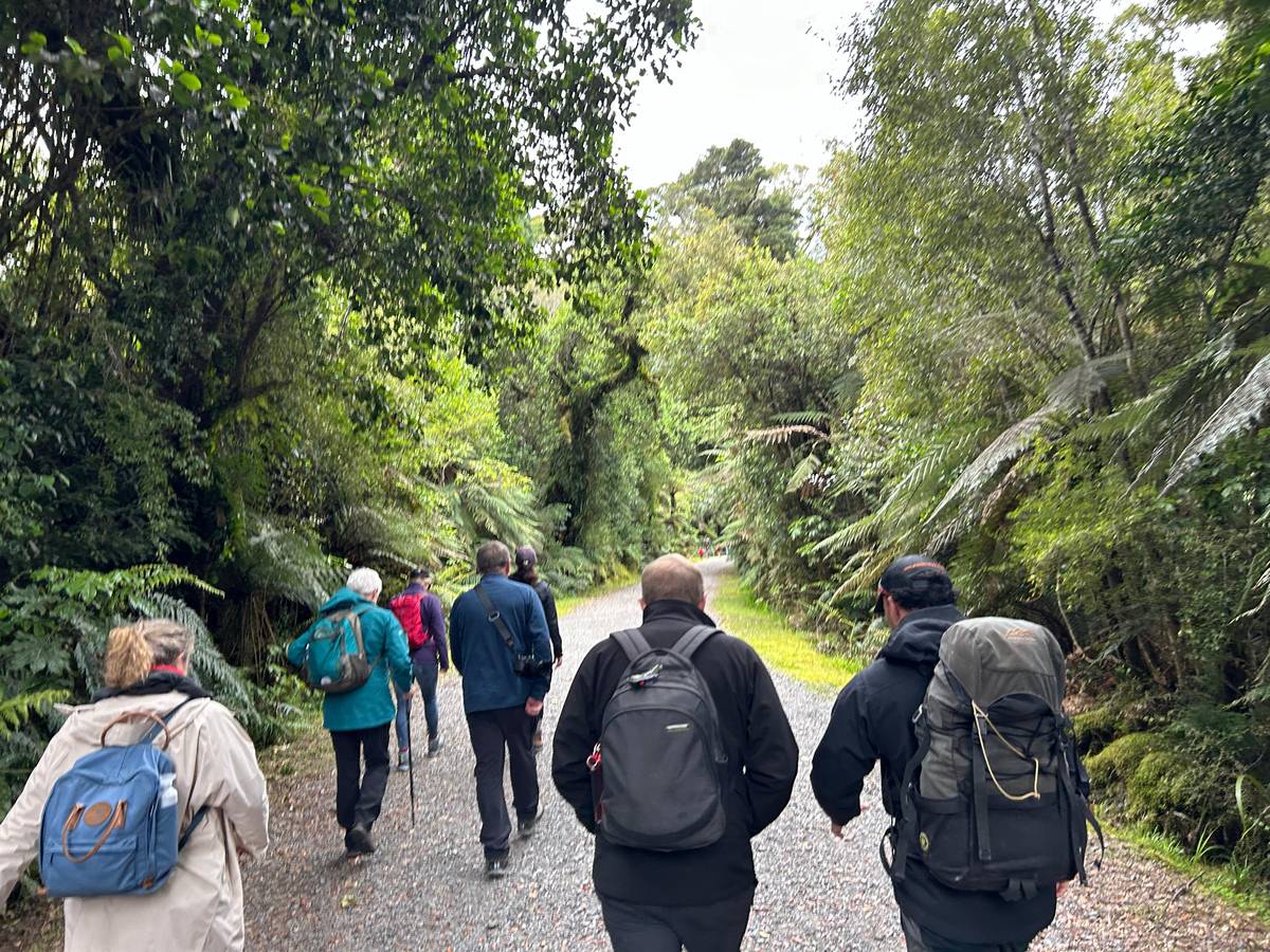
The whole Lake Matheson walk is a 4.4 km loop of about 1 hr 30 min, graded easy to intermediate.1 From the car park you cross a suspension bridge over Clearwater Stream and follow a gravel path through kahikatea, rimu and tōtara to Jetty Lookout. That first leg is the wheelchair-accessible part: car park to Jetty Lookout and back is 2.4 km and takes about 45 minutes.2
From Jetty Lookout the circuit carries on round the lake. DOC gives 15 minutes through the forest to the View of Views Lookout at the top end of the lake, reached by a signposted side track with steps.10 This is the classic framed view, with the mountains between native trees and the water at your feet.
Reflection Island comes next, where steps lead down to a viewing platform over the water. From there DOC allows 35 minutes back to the car park through the wetland at the eastern end of the lake.11 The track works in either direction, so if the sun or a crowd suggests the other way round, take it.
Walks compared
Choose your walk
| Walk | Distance | Time | Best for |
|---|---|---|---|
| Jetty Lookout | 2.4 km return | 45 min | Wheelchairs & short visits |
| Lake circuit | 4.4 km loop | 1 hr 30 min | The full set of views |
| Lake Gault | 8 km return | 3 hr | A quieter mirror lake |
| Galway Beach | 6.8 km return | 3 hr 30 min | Coast & winter seals |
Times of day
Dawn, midday or dusk at the lake
Stillest water Easiest
Midday
Between other plans
- Wind
- Often a breeze
- Peaks
- Cloud may build
- Good for
- The forest walk
 Golden light
Dusk
After a glacier day
- Wind
- Often drops
- Light
- Warm on the peaks
- Bring
- Insect repellent
Decision helper
How much of the lake to walk
Fit the walk to your time and energy
The reflections are thanks to Lake Matheson's dark waters, coloured by organic matter from the forest floor.
When the mirror works
Reflections need still water, and still water needs no wind. DOC says dawn and dusk are the best times, and that reflections are best on a fine, windless day.3 In the middle of the day a light breeze often ruffles the surface, and the clouds that build over the Alps can hide the summits even when the lake is calm.
That makes timing a gamble you can improve but not control. If you are in Fox for more than one evening, check the sky after dinner and go when the peaks are clear. A guided Lake Matheson nature tour on GetYourGuide says the same in its own way: it recommends early evening for the best chance of mirror-like reflections, and runs rain or shine.
The season matters for crowds rather than for the mirror. DOC notes that the walk is popular and gets busy during the summer season, from November to April.3 Early morning is the quietest time to stand on the jetty, and a misty dawn can be beautiful even when the full reflection never appears.
Map
Fox Glacier, its walks and the road in
The township and the short walks around it, the two glaciers side by side, and State Highway 6 from Queenstown, Wanaka and Christchurch.
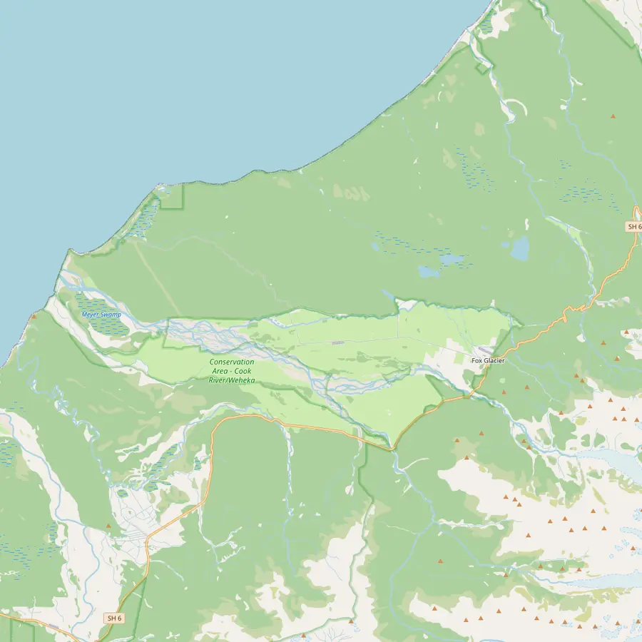 1Fox Glacier township2Lake Matheson3Lake Gault4Peak Viewpoint5Fox Glacier South Side viewpoint6Gillespies Beach
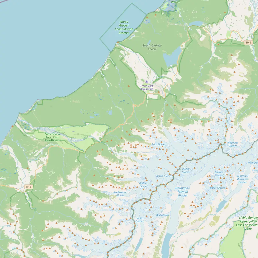 1Fox Glacier township7Fox Glacier8Franz Josef9Franz Josef Glacier2Lake Matheson
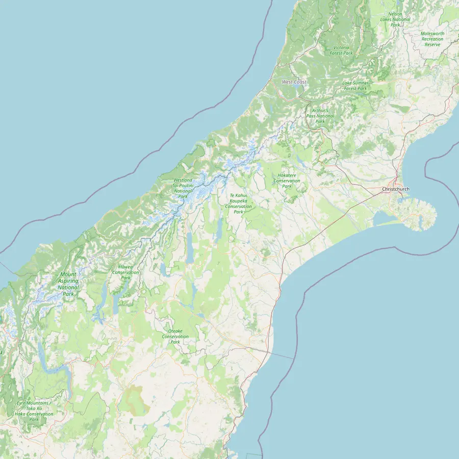 1Fox Glacier township8Franz Josef10Hokitika11Christchurch12Haast13Haast Pass14Wanaka15Queenstown
- 1Fox Glacier township
On State Highway 6, 171 km south of Hokitika.14
In Google Maps ↗ - 2Lake Matheson
A 4.4 km loop of 1 hr 30 min, 5 min by car from the township.14
In Google Maps ↗ - 3Lake Gault
8 km return from the Lake Matheson car park, about 3 hours.13
In Google Maps ↗ - 4Peak Viewpoint
A 9 km drive towards the coast, with views of the neve.15
In Google Maps ↗ - 5Fox Glacier South Side viewpoint
At the end of a 6.4 km return walk of about 2 hours.16
In Google Maps ↗ - 6Gillespies Beach
A 21 km drive from the township, at the coast.17
In Google Maps ↗ - 7Fox Glacier
13 km long, its face less than 300 m above sea level.1819
In Google Maps ↗ - 8Franz Josef
The twin township, 30 min by car to the north.20
In Google Maps ↗ - 9Franz Josef Glacier
Its face is also less than 300 m above sea level.21
In Google Maps ↗ - 10Hokitika
The closest commercial airport, with daily flights from Christchurch.22
In Google Maps ↗ - 11Christchurch
The city with daily flights to Hokitika.22
In Google Maps ↗ - 12Haast
The southern way in on SH6, about two hours to the park.23
In Google Maps ↗ - 13Haast Pass
Tiora-patea, 'the way is clear', on the road from Wanaka.24
In Google Maps ↗ - 14Wanaka
3h 30m by road to Fox Glacier.20
In Google Maps ↗ - 15Queenstown
4h 30m by road to Franz Josef.25
In Google Maps ↗
Checklist
Before you walk
01
Pack
- Your own drinking water
- Insect repellent for sandflies
- A warm layer for dawn or dusk
02
At the lake
- Take your rubbish home
- Mobility parking at the car park
- No boats and no drones without a permit
Cost for your group
Guided walks and the heli-hike
Pick a trip and the number of people
People
Total from$130
pp from $65
Check availabilityfree cancellationWe take the lowest GetYourGuide fare for each trip, multiply it by the people in your party and show it in your currency at European Central Bank rates; your date sets the real total.
Video
Walking around Lake Matheson on the West Coast
We only contact YouTube after you tap the play button.
Getting there and parking
The lake is close to town. From Fox Glacier, follow Cook Flat Road for 5 km and take the signposted road on the right; DOC gives 5 minutes by car from Fox Glacier and 30 minutes from Franz Josef.4 The car park has free parking for cars and campervans and three marked mobility spaces.5
Keep driving along the same road and you reach more stops worth your time. Peak Viewpoint near Fox Glacier, 9 km from the township towards the coast, looks up at the neve of Fox Glacier and the Southern Alps, and DOC calls it outstanding at sunset on a cloudless day.15 Further on, Gillespies Beach is a 21 km drive from the township.17
If you do not have a car, the guided nature tour picks up and is listed at 4 hours with a group limited to 10 participants. It is rated 4.81 from 17 reviews and starts from $65. A walk with a guide also adds the stories of the forest, which are easy to miss on your own.
Beyond the loop: Lake Gault and the coast
For a longer outing, the Lake Gault Track leaves the Lake Matheson loop and climbs 200 m through original podocarp forest, with several small stream crossings.26 It is 8 km return and takes about 3 hours.13 At the top a second lake mirrors the same mountains, and DOC says early morning is the best time, when the lake is calm and before clouds hide the peaks.27
Gillespies Beach is a different world: a wild grey beach with the Alps behind you. There are five walks there.28 The longest, the Galway Beach track, takes 3 hr 30 min return over 6.8 km.12 Galway Beach is a winter haul-out colony for seals, so keep your distance and never step between a seal and the sea.29
These extras turn the lake into a half-day or full-day plan, and they work well on a day when cloud grounds the helicopters. The forest walks are pleasant in soft rain, and if the sky clears in the evening you are already in the right place for the reflection.
What to bring and the rules at the lake
Bring water: DOC says drinking water is not available at the lake.30 Toilets, including an accessible one, are at the car park, and there are seats and a picnic table along the track. There are no rubbish bins, so carry your rubbish out. Insect repellent is essential, because sandflies can be fierce here.
No boats, kayaks, canoes or watercraft of any kind are allowed on Lake Matheson.30 Drones need a DOC permit on conservation land, and the lake's calm is part of what you came for. Keep to the track, too: the wetland and forest edges are home to birds you may hear long before you see them.
Wear proper shoes rather than sandals, since the gravel path can be wet and muddy after rain, and take a warm layer for dawn or dusk. A tripod helps for low-light photos of the reflection, but a phone held steady on the jetty rail works too. The best picture often comes a few minutes after sunset, when the peaks glow and the water turns dark.
Lake Matheson and a day on the glacier
The lake fits neatly around a heli-hike. The heli-hike takes 4 hours from check-in to return, so a morning slot leaves the afternoon free and the evening for the lake. If your flight is cancelled by cloud, the lake is the obvious plan B, and it often looks moody and beautiful in grey weather.
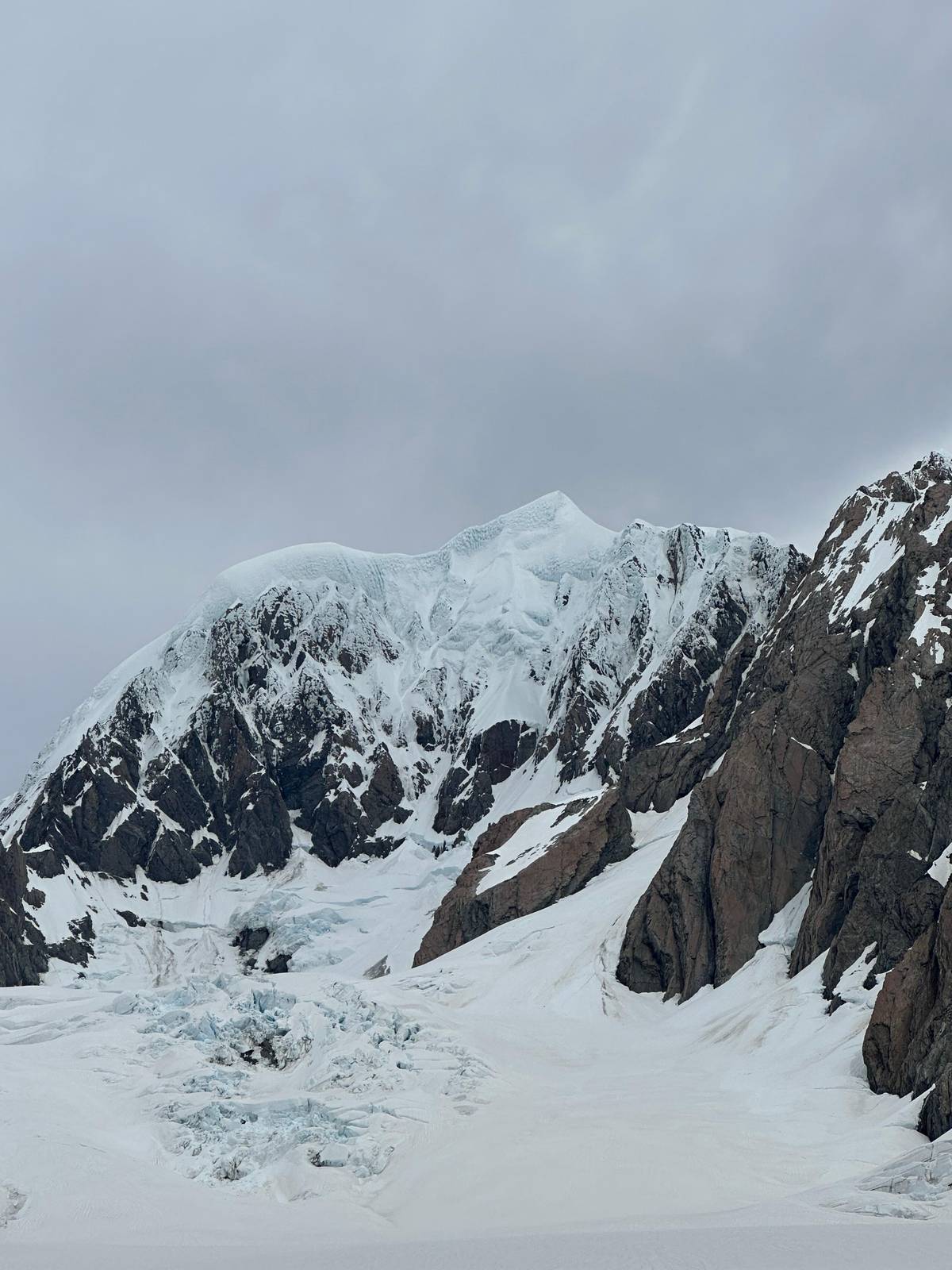
From the jetty you look straight up at the snowfields that feed Fox Glacier, which helps the glacier make sense. After a day on the ice, seeing where it starts, high among the peaks, closes the circle. After a scenic flight it works the other way round: you will recognise the neve you landed on.
If you can only fit in one short walk in Fox, this is the one. It is easy, close, free and different from anything you do on the glacier itself, and on the right evening it is a place you will not forget.
Pick your day
Walk on Fox Glacier with a guide
Flights, boots, crampons and rain gear included; free cancellation up to a day before.


You ask,we answer.
How long is the Lake Matheson loop?
4.4 km, about 1 hr 30 min. DOC grades the circuit easy to intermediate.1
Is there a shorter walk to the lake view?
Yes, to Jetty Lookout. Car park to Jetty Lookout and back is 2.4 km and about 45 minutes.2
When are the reflections best?
Dawn and dusk. DOC says reflections are best on a fine, windless day.3
Is the walk wheelchair accessible?
The first section is. The track from the car park to Jetty Lookout suits wheelchairs.2
How far is Lake Matheson from Fox Glacier?
About 5 minutes by car. Follow Cook Flat Road for 5 km, then turn right at the sign.4
Can you kayak on Lake Matheson?
No. No boats or watercraft of any kind are allowed on the lake.30
Does the walk get busy?
In summer. DOC says it gets busy from November to April.3
Is there a guided Lake Matheson tour?
Yes. A 4-hour guided nature tour with pickup starts from $65.
Sources
What this text is based on
- 1Department of ConservationLake Matheson/Te Ara Kairaumati Walk↩
- 2Department of ConservationLake Matheson/Te Ara Kairaumati Walk↩
- 3Department of ConservationLake Matheson/Te Ara Kairaumati Walk↩
- 4Department of ConservationLake Matheson/Te Ara Kairaumati Walk↩
- 5Department of ConservationLake Matheson/Te Ara Kairaumati Walk↩
- 6Department of ConservationLake Matheson/Te Ara Kairaumati Walk↩
- 7Department of ConservationAoraki/Mount Cook National Park↩
- 8Department of ConservationFox Glacier area↩
- 9Department of ConservationFox Glacier area↩
- 10Department of ConservationLake Matheson/Te Ara Kairaumati Walk↩
- 11Department of ConservationLake Matheson/Te Ara Kairaumati Walk↩
- 12Department of ConservationGillespies Beach walking tracks↩
- 13Department of ConservationLake Gault Track↩
- 14Department of ConservationFox Glacier area↩
- 15Department of ConservationFox Glacier area↩
- 16Department of ConservationFox Glacier South Side Walkway/Cycleway↩
- 17Department of ConservationGillespies Beach walking tracks↩
- 18Department of ConservationFox Glacier area↩
- 19Department of ConservationFox Glacier area↩
- 20Tourism New ZealandFox Glacier↩
- 21Department of ConservationFranz Josef Glacier/Kā Roimata o Hine Hukatere↩
- 22Department of ConservationWestland Tai Poutini National Park↩
- 23Department of ConservationWestland Tai Poutini National Park↩
- 24Tourism New ZealandHaast Pass↩
- 25Tourism New ZealandFranz Josef Glacier↩
- 26Department of ConservationLake Gault Track↩
- 27Department of ConservationLake Gault Track↩
- 28Department of ConservationGillespies Beach walking tracks↩
- 29Department of ConservationGillespies Beach walking tracks↩
- 30Department of ConservationLake Matheson/Te Ara Kairaumati Walk↩